Eastern Africa
Flag of Eritrea
A Red Sea nation that fought 30 years for its name on the map.
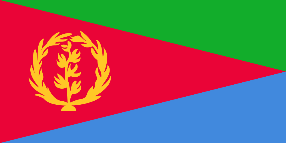
Colours, by share of the flag
- #d80030 38%
- #00a818 24%
- #3078d8 24%
Measured from the flag artwork itself, so shares are approximate and emblems get folded into the nearest tone.
Eritrea in numbers
| Official name | State of Eritrea |
|---|---|
| Capital | Asmara |
| Region | Eastern Africa, Africa |
| Population | 5,347,896 |
| Area | 117,600 km² · 45 people per km² |
| Currency | Eritrean nakfa (ERN) |
| Languages | Tigrinya, Arabic, English |
| Country codes | ER · ERI · .er |
| Coastline | Has a coast |
Things worth knowing
- Eritrea won independence from Ethiopia in 1993 after a three-decade war, one of Africa's longest armed struggles.
- Its capital, Asmara, is so rich in 1930s Italian modernist architecture that UNESCO listed the whole city as a World Heritage Site.
- The Danakil Depression in Eritrea's southeast is among the hottest inhabited places on Earth, with average temperatures topping 30°C.
Did you know
Eritrea's coastline along the Red Sea stretches over 1,000 kilometers, and its waters hold more than 350 islands, including the Dahlak Archipelago.
Neighbours
Can you name it without the caption?
Play the free flags quiz in your browser, or get GeoSpark on Android for all 196 countries with capitals, maps and spaced review.
Country data from the mledoze/countries dataset under ODbL 1.0. Flag artwork from the same dataset. All 196 flags.