Micronesia
Flag of Kiribati
A scattered nation straddling every hemisphere at once.
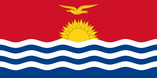
Colours, by share of the flag
- #c00018 43%
- #003078 21%
- #f0f0f0 14%
Measured from the flag artwork itself, so shares are approximate and emblems get folded into the nearest tone.
Kiribati in numbers
| Official name | Independent and Sovereign Republic of Kiribati |
|---|---|
| Capital | Tarawa |
| Region | Micronesia, Oceania |
| Population | 119,446 |
| Area | 811 km² · 147 people per km² |
| Currency | Australian dollar (AUD) |
| Languages | English, Gilbertese |
| Country codes | KI · KIR · .ki |
| Coastline | Has a coast |
Things worth knowing
- Kiribati's islands are spread across an enormous swath of the Pacific, straddling both the equator and the 180th meridian so the country lies in all four hemispheres.
- Because it sits where the calendar day begins, Kiribati is among the first places on Earth to greet each new day.
- Most of Kiribati is made of low-lying coral atolls, leaving the nation acutely vulnerable to rising sea levels.
Did you know
Kiribati once shifted the international date line eastward so the whole country could share the same day.
Can you name it without the caption?
Play the free flags quiz in your browser, or get GeoSpark on Android for all 196 countries with capitals, maps and spaced review.
Country data from the mledoze/countries dataset under ODbL 1.0. Flag artwork from the same dataset. All 196 flags.